Transport
Inland Routes Update
Work is continuing on plans to improve key inland routes that could be used during any future closure of the A379. The aim is to make these routes safer and more resilient through a programme of new and improved passing places, together with better signage and road safety measures.
Published: 7 September 2026

Routes Overview
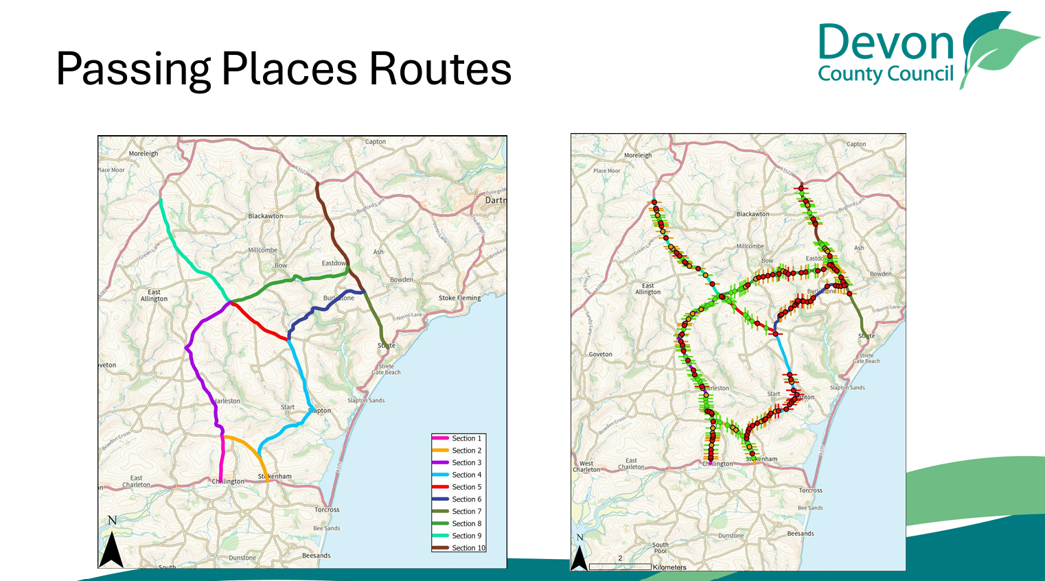
This map shows the inland route network being considered, along with existing and proposed passing places. The focus is on improving connectivity and helping traffic move more safely along narrow sections of road.
Progress So Far
Good progress has been made, including:
- Securing approval for the first phase of work.
- Completion of ecology surveys.
- Further dormouse surveys due to begin in September.
- Discussions with landowners now underway.
- Detailed design work continuing.
Priority Route Sections
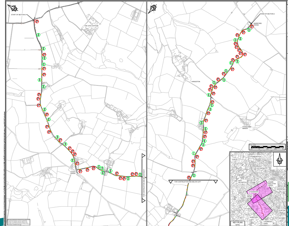
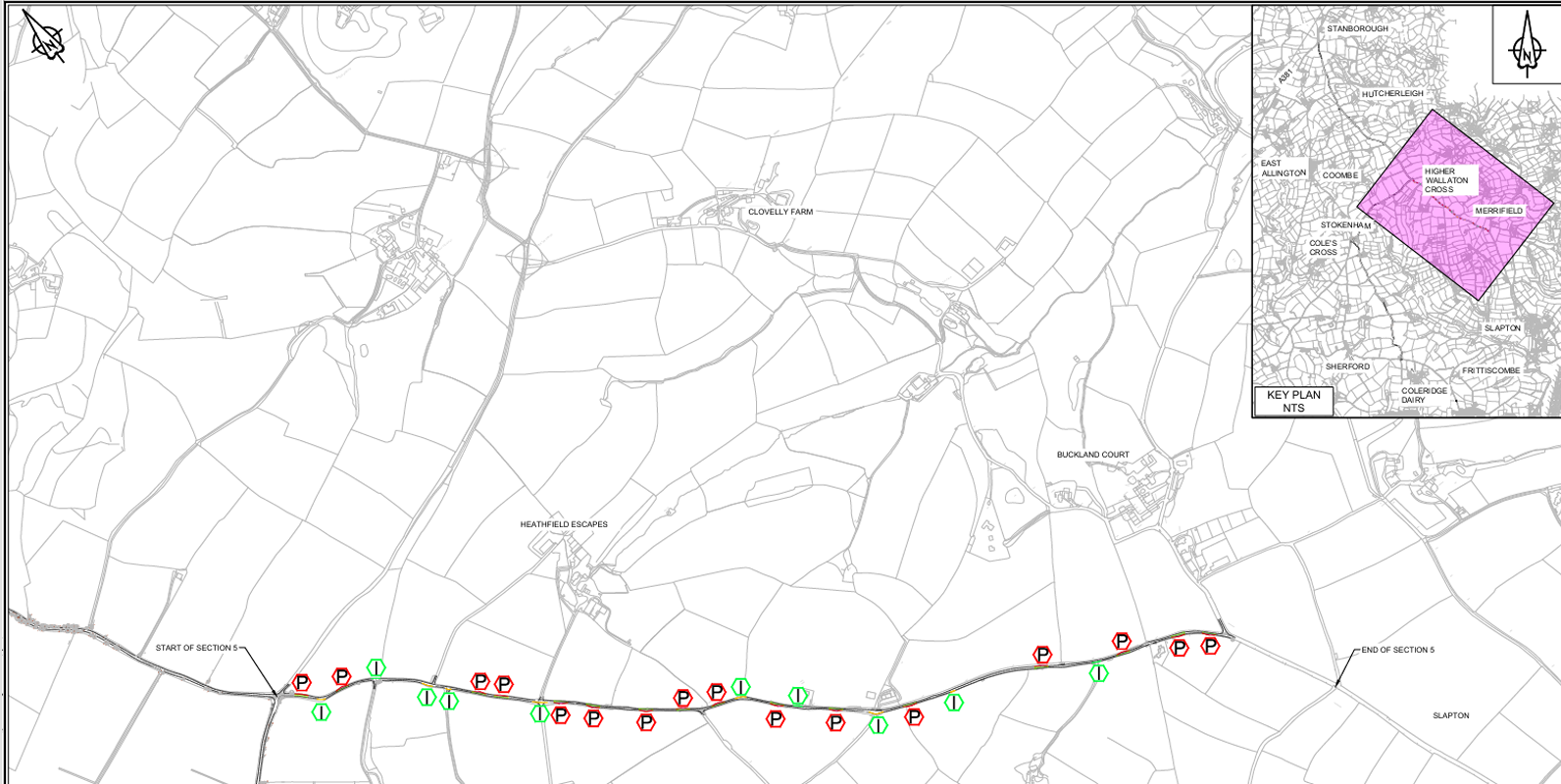
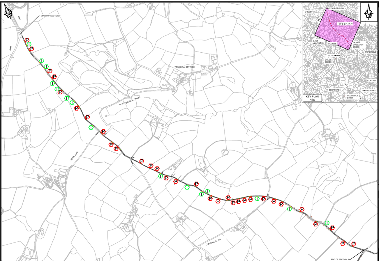
These maps show the three priority sections currently being considered by the Working Group, where improvements to existing and proposed passing places are being developed.
What Happens Next?
Further surveys and design work will continue over the coming months. No construction timetable has yet been confirmed, but the Parish Council will continue to work with partners through the Slapton Line Partnership and keep residents updated as the project progresses.
Documents
Recent News
- ROAD TRAFFIC REGULATION ACT 1984 SECTION 14 THE COUNTY OF DEVON (TEMPORARY RESTRICTION) (DEER BRIDGE CROSS TO SANDS ROAD, SLAPTON)
- Slapton Parish Council Management of Signage Guidelines
- SLAPTON PARISH COUNCIL ONE-OFF COMMUNITY GRANT APPLICATIONS closing date 30th November 2026
- Slapton Community Café Set for November Return—Volunteers Needed!
- Notice of Two Vacancies in the Office of Councillor for Slapton Parish Council